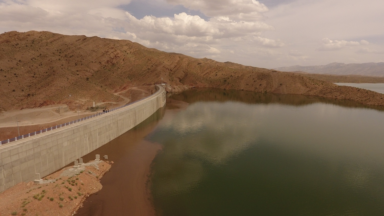
ROODBAL STORAGE DAM
Project Site :
Roodbal dam is located in Kilometer ( Km) 20 of Darab-Estahban Regional road .
Neighboring counties of dam site include : from north–Neyriz and Estahban counties, from West – Fasa and Jahrom, and from south Darab county.
Technical Specifications of Roodbal Storage Dam:
The elevation of riverbed at dam site :1307 meter above mean sea level (M.S.L)
The area of watershed to dam site : 910square Keilometers
Annual mean precipitation of water shed : 365 millimeters
Average, minimum and maximum annual inflow are quall to 110.9.Min=28.6 (1349-50 water year) and Max=386.9 MCM (1371-72 water year) respectively in a 30 year length of record.
Surface area of reservoir at Max water level.(1380.4m above M.S.L) = 3.27 Km2
Reservoir volume at maximum water level :95 million cubic meter
Inflowing floods to Reservoir with 100 year return period : 1000 CMS
Inflowing floods to Reservoir with 1000 year ( yr. ) return period : 1950 CMS
Inflowing floods to reservoir with 10000 year return period : 3100 CMS
Dam type : earth and rock fill with inclined clay core
Crest Length : 485m excluding the lengths of fuse-plug and spillway bridge
Crest width : : 8 m
Dam elevation from riverbed : 75 m
Dam elevation from foundation : 83 m
Crest elevation : 1381 m above M.S.L
Base width at largest section : 330 m
N.WL ( Normal water Level ) : 1378 m above M.S.L
Reservoir volume at normal elevation : 82 million cubic meter ( M.C.M )
Reservoir Surface at N.W.L. : 2.7 km 2
Specification of Water Diversion Tunnel :
Diversion tunnel length : 430 m
Tunnel diameter ( internal ) : 7 m
Average tunnel slope : 1.8 percent ( % )
Outflow capacity of tunnel during temporary diversion : 520 C.M.S
Main Spillway :
Spillway type : Gated with five radial gates. Dimension 10.5 m ´ 7 m
Spillway length along the its Axis : 230 m
Spillway capacity : 1750 CMS
Auxiliary Spillway ( fuse- plug ) : Earth type with bottom lining
Auxiliary Spillway capacity : 2350 CMS ( Fuse plug )
Crest length at maximum water level : 139 m
Water Proofing System : Grout curtain
Drilling and grouting of 60,0000m together with 9000 m in Radiolarite.
Consolidating grouting : 21000 m at clay core interface with rock.
Project Goals :
1- Control and regulation the unexpected flows and important floods of Roodbal river with construction of Roodbal storage dam. Preventing watershed wastewater and increasing usable surface water potential of Darab plane by providing average annul 104 MCM for potable and irrigation water (15MCM for potable water), from the dam and enhancing and building up the groundwater level of Darab plane by important reduction in water use of wells.
2- To bring under full cultivation a 9,000 hectares net arable land in the north, and mid sections of Darab plane with pressurized watering.
3- Creating 7 thousands new jobs when this project is completed and as a result of the trend of migration of farmers toward the cities, is reversed with more help from auxiliary factories ( related small industries ).
4- To improve environment and bring microclimate change to the region by a 270 hectares lake evaporation and encouraging forestry, fisheries and recreation activities .
5-To provide 15 MCM water annually for the Darab and Zarindasht cities to provide most part of domestic water, also providing about 9MCM annually for Khossuyeh dam arable land.